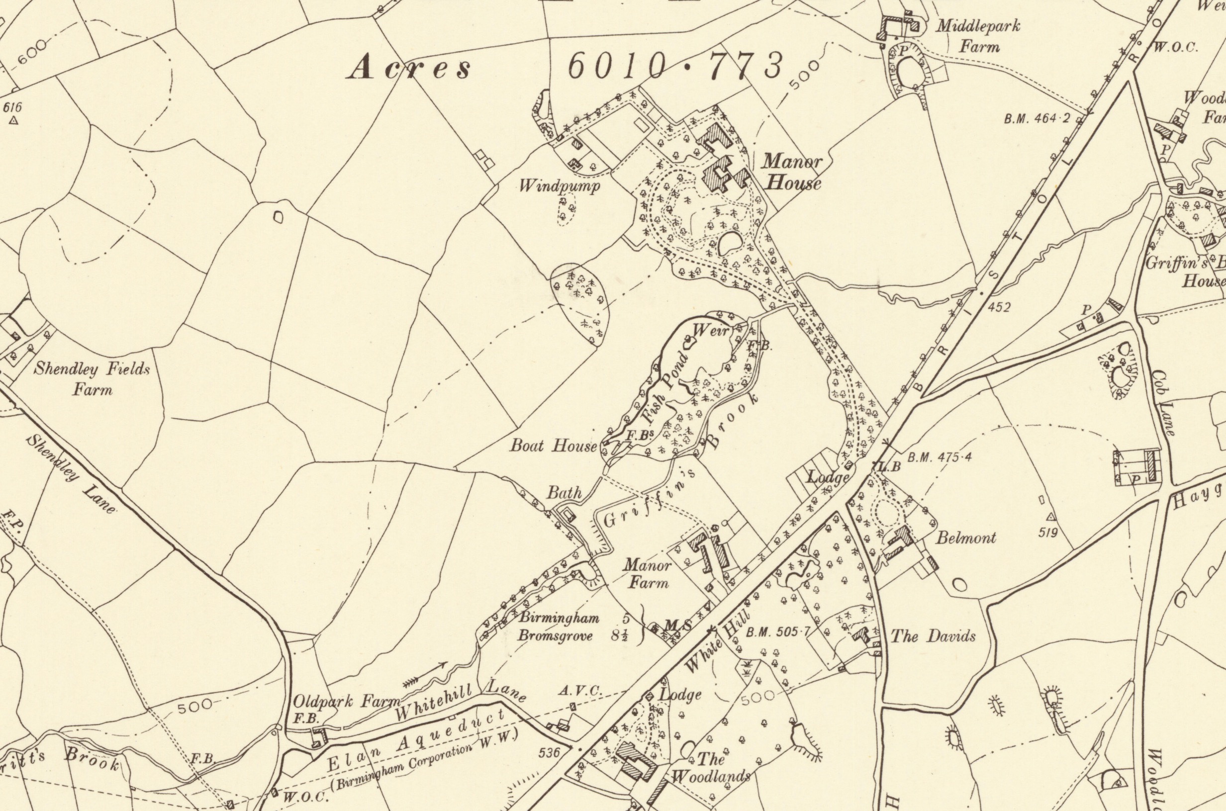
The Ordnance Survey (Second Edition) Six Inch Map 1905

 1904 Reduced

'Reproduced with the permission of the National Library of Scotland'

The main change within the park shown on the OS Map of 1905 (surveyed in 1902-03) is the layout of Manor Farm, comprising two opposing ranges of buildings separated by an accessway off Bristol Road South. The north-eastern range is composed of two detached elements, which are now the City’s Parks Depot. The opposite range is also L-shaped in plan. The south-eastern ends of both these ranges were sub-divided and were probably in use as stables or cowsheds. To the rear the L-shaped structure was the ‘Cadbury Barn’. There is also the Lodge with a garden adjoining modern Bristol Road South. 

The large pond is now labelled ‘Fishpond’. To the south of the fishpond a new culverted course of the Griffin’s Brook has been cut to the southeast of the historic route. As mapped, it does not appear to have been joined to the historic course of the brook at its southern end. The L-shaped building (White Hill Farm) in the extreme south-eastern angle of the park continues to be mapped, together with Old Park Farm (along Whitehill Lane). Outside the park the ornamental gardens of the Manor House are mapped to the south of the house. The park surrounds continue to be rural in character into the 20th century, despite some development along the south-eastern frontage of modern Bristol Road South.

Return to Maps and Plans

Link to larger version 

The Northfield Tithe 1840
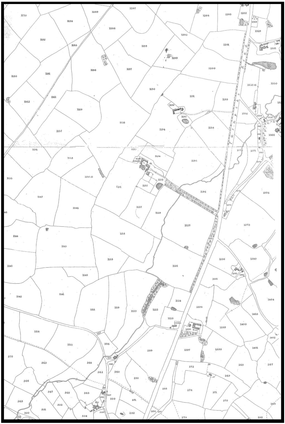
1840 tithe map pngThe 1840 Tithe Map is the earliest detailed map of the park and surrounds. Earlier historic mapping is confined to the historic core of Northfield village to the south of the park. Accurate Tithe maps were produced in the late 1830s to meet the requirements of the Tithe Commutation Act 1836, which changed the basis of how tithes (payments by tenants to the Parish and later to landowners) were calculated. Formerly, the payment was a tenth of farm produce, but the Act changed this to a cash payment based on the value of land, hence the need for accurate mapping and records of land use. Click here for a larger version. 

The fieldnames within the park are listed below: 

  • 1137 Little Hill
  • 1129 The Moor 
  • 1128 The Flat Park 
  • 1136 Over Hill 
  • 1138 Long Leasow 
  • 1139 Little Corner Piece (Probably)
  • 1126 Over Park 
  • 1120 Great Meadow 
  • 1122 Marlpit Leasow 
  • 1124 Jones’ Leasow 
  • 1123 Cottage, buildings and field -
  • 1116 Pleck and house 
  • 1117 Foredrive 

Field 1142 (‘Black Haynes Close’) has given its name to the modern road of the same name. Field 1186 (‘Black Leasow’) to the north of the modern park could refer to black, peaty ground or a possible further burnt mound, although no streams are mapped nearby. It contains an L-shaped stand of trees. 

At the time of the survey the main landscape feature was a Turnpike Road, now Bristol Road South, forming part of the south-eastern park boundary. Hole Lane is believed to be a medieval holloway, a route which is lower than the surrounding landscape, as a result of the passage of traffic, in particular carts, which has worn away the surface over a long period of time. To the south and southwest of the park Whitehill Lane and Shenley Lane respectively are also mapped. 

Griffins Brook, is shown running very approximately north-south bisecting the southern part of the park. It feeds two fishponds, together forming an L shaped arrangement, between fields 1120 and 1122. From the northern end of the fishponds it turns west, running along part of the northern boundary of field 1120. Here the brook adjoins an earth bank which remains visible to the present, possibly forming a dam (see below). The brook then runs northwards through field 1126 and forms the boundary bisecting fields 1128 and 1129. Further to the north it crosses New House Farm Drive, and heads to the northeast, passing underneath modern Bristol Road South. 

To the north of the park the buildings of the New House (later The Manor House) are illustrated, accessed by a tree-lined road (now New House Farm Drive) off modern Bristol Road South. Land to the southeast was divided into small enclosures, possibly ornamental or kitchen gardens. Middle Park Farm (1192), adjoining a marlpit (1193) is seen to the northeast. Within the park a notable new landscape feature is the belt of trees along the eastern boundary, adjoining modern Bristol Road South.

A number of buildings are shown within the park. A house (White Hill Farm) and outbuilding, described as ‘cottage, buildings and field’ are mapped in the angle between modern Bristol Road South and Whitehill Lane (1123). A further complex of buildings within land parcel 1117, comprises Old Park Farm (formerly Park Gate Farm), a farmhouse, stables and outbuildings. Between fields 1123 and 1124 is an oval pit, possibly a marlpit, probably used for the extraction of clay for building. 

The park and the surrounding area are divided into irregularly-shaped fields suggesting that they were laid out in several episodes, over an extended period. Evidence of possible enclosures in the deer park is shown by the field boundaries at west of the present park and also those containing the playing fields and Great Meadow. 

Thanks to Alex Jones for this information

Return to Maps and Plans

Back to top of page
Maps and Plans of the Park

Park Plan 2015Northfield Tithe Map 1840.fnl.opt500x750org.There are several maps and plans of the park, which help to tell its story. Prior to the 19th century, the land that is now the park was farmland. Indeed, areas of the present park were fields until the 1950s when City Council took over its management.

In 2015 the City and Friends of Manor Farm Park developed a large scale plan, which can be seen on notice boards in the Park. In 2019 the National Lottery Heritage Fund awarded the Friends of Manor Farm Park a grant to develop a Heritage Trail.

An early detailed map that shows field boundaries is the 1840 Northfield Tithe Map. These maps were accurate records of land use and ownership that were used to calculate the payments (tithes)to each Parish. 

Ordnance Survey started the detailed mapping of Great Britain in the 1830s and the series show the area developed from being solely rural to one with a growing industrial focus. Farms developed, some disappeared and owners of land changed them to provide leisure and entertainment. The First Edition Six-inch to a Mile (1884) shows a few changes from the Tithe Map such as the Fish Pond with a Boat House at its South-West shore. 

The 1905 map shows the biggest changes to the land so far; New House Farm had become the Manor House; its ornamental gardens have been developed and landscaped. Manor Farm had been built at the entrance and work has started on the diversion of Griffins Brook around the lake. Though the 1916 OS map shows little change to the previous edition, there are some changes to the Manor Farm outbuildings and the new culvert, a part of which was first seen in the 1904 edition is now finished and completes the diversion of Griffins Brook around the lake.

OS map 1937

A later map, the OS 1938 Map was surveyed in 1937 (but not released until 1945). It shows some changes to the park. However, some of the more interesting changes can be seen to the North of the park with the development of the housing estate on surrounding farmland.
This 1955 OS map shows the further development of the estates surrounding the park. This is the year that Birmingham City Council took over management of the park for the George Cadbury (Public Park) Trust that still owns the park, but there is little evidence of this on the map. 

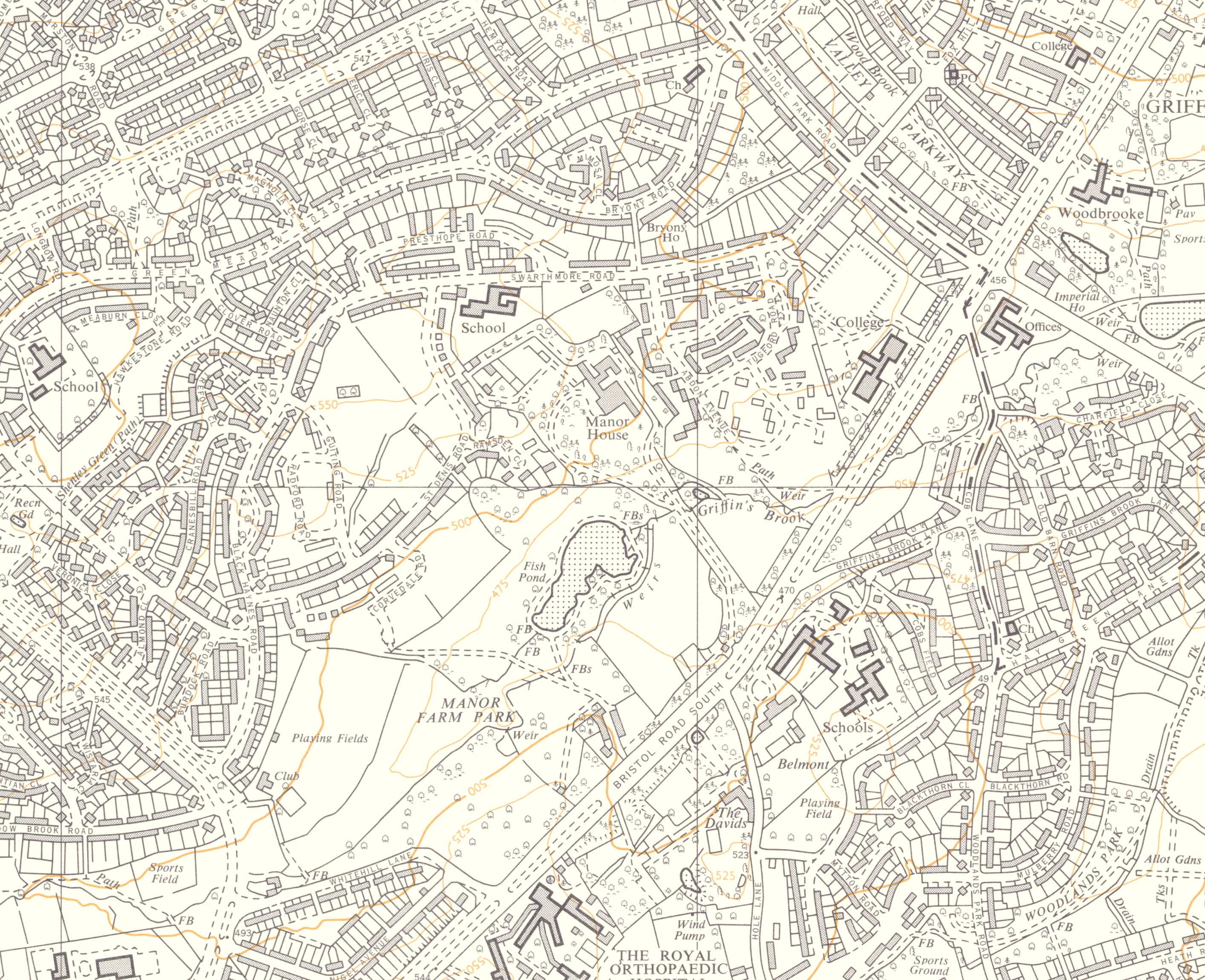
The park, first mentioned on the 1968 OS map, has a similar layout as today. Many of the estates surrounding the park today are shown, but some areas have yet to be built; there are few houses on Guiting, Radford and Corvedale Roads. The student accommodation at Griffin Close is yet to be developed.1968 reduced

Tony Sames, a local wildlife expert and historian has produced plans of the park and its wildlife. He and Nina Griffiths have plotted trees in the park and are documenting the species in the Ancient Hedgerow that forms the boundary between the Great Meadow and the playing fields at Shenley Lane Sports Association. 

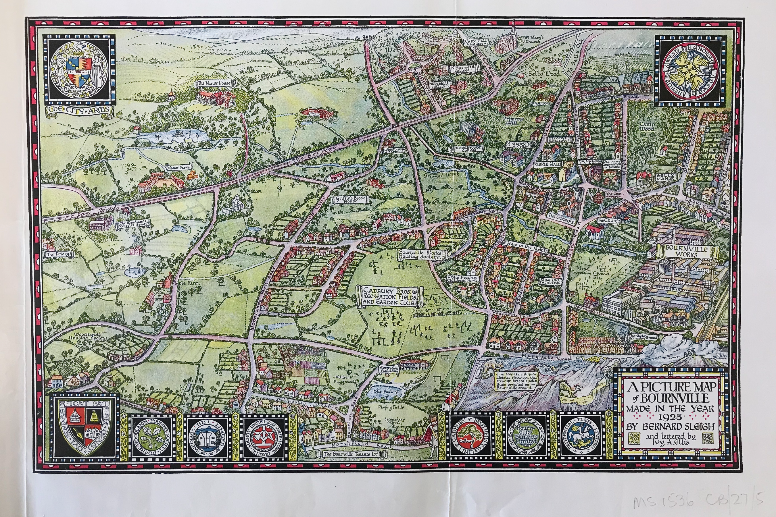
Bernard Sleigh map of Bournville 1923 1Wider maps of the Bournville area, such as the Bernard Sleigh 1923 pictorial map [right], show the development of the Bournville and Weoley estates and how farmland was turned into housing.  

Thanks to Alex Jones, Tony Sames and Peter Mayer for their contribution to the information on these pages. Back to Main Menu

Back to top of page