Maps and Plans of the Park

 There are several maps and plans of the park, which help to tell its story. Prior to the 19th century, the land that is now the park was farmland. Indeed, areas of the present park were fields until the 1950s when City Council took over its management.
In 2015 the City and Friends of Manor Farm Park developed a large scale plan, which can be seen on notice boards in the Park. In 2019 the National Lottery Heritage Fund awarded the Friends of Manor Farm Park a grant to develop a Heritage Trail.
An early detailed map that shows field boundaries is the 1840 Northfield Tithe Map. These maps were accurate records of land use and ownership that were used to calculate the payments (tithes)to each Parish.
Ordnance Survey started the detailed mapping of Great Britain in the 1830s and the series show the area developed from being solely rural to one with a growing industrial focus. Farms developed, some disappeared and owners of land changed them to provide leisure and entertainment. The First Edition Six-inch to a Mile (1884) shows a few changes from the Tithe Map such as the Fish Pond with a Boat House at its South-West shore.
The 1905 map shows the biggest changes to the land so far; New House Farm had become the Manor House; its ornamental gardens have been developed and landscaped. Manor Farm had been built at the entrance and work has started on the diversion of Griffins Brook around the lake. Though the 1916 OS map shows little change to the previous edition, there are some changes to the Manor Farm outbuildings and the new culvert, a part of which was first seen in the 1904 edition is now finished and completes the diversion of Griffins Brook around the lake. 
A later map, the OS 1938 Map was surveyed in 1937 (but not released until 1945). It shows some changes to the park. However, some of the more interesting changes can be seen to the North of the park with the development of the housing estate on surrounding farmland.
This 1955 OS map shows the further development of the estates surrounding the park. This is the year that Birmingham City Council took over management of the park for the George Cadbury (Public Park) Trust that still owns the park, but there is little evidence of this on the map.
The park, first mentioned on the 1968 OS map, has a similar layout as today. Many of the estates surrounding the park today are shown, but some areas have yet to be built; there are few houses on Guiting, Radford and Corvedale Roads. The student accommodation at Griffin Close is yet to be developed.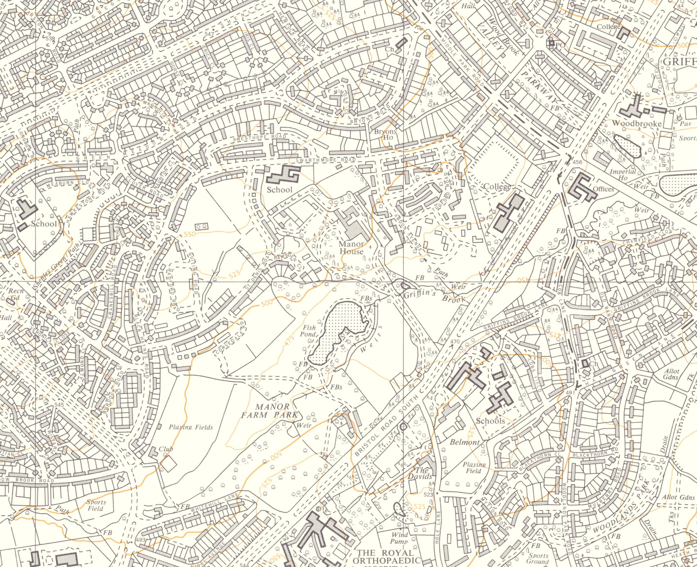
Tony Sames, a local wildlife expert and historian has produced plans of the park and its wildlife. He and Nina Griffiths have plotted trees in the park and are documenting the species in the Ancient Hedgerow that forms the boundary between the Great Meadow and the playing fields at Shenley Lane Sports Association.
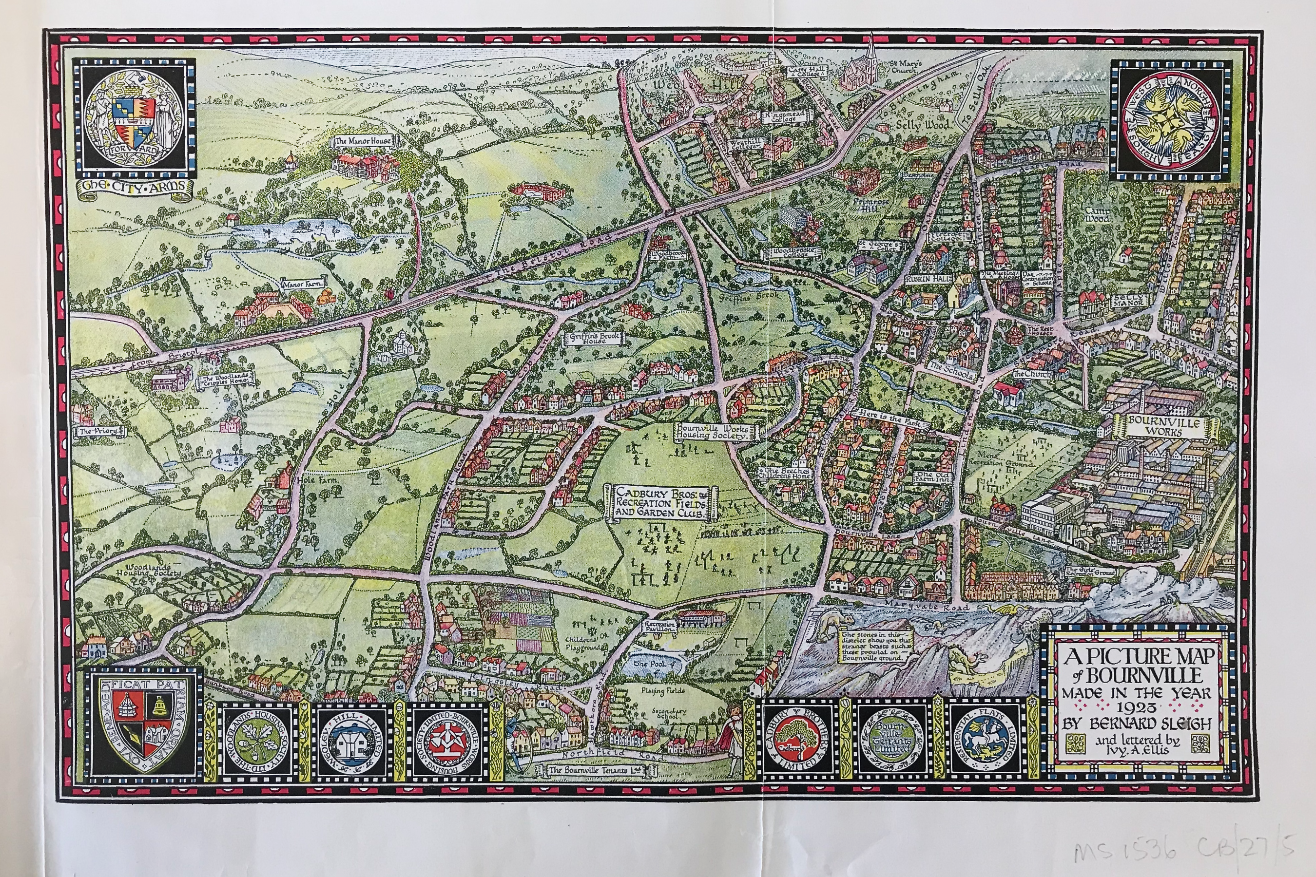 Wider maps of the Bournville area, such as the Bernard Sleigh 1923 pictorial map [right], show the development of the Bournville and Weoley estates and how farmland was turned into housing.
Thanks to Alex Jones, Tony Sames and Peter Mayer for their contribution to the information on these pages. Back to Main Menu