The Ordnance Survey (Second Edition) Six Inch Map 1905
'Reproduced with the permission of the National Library of Scotland'
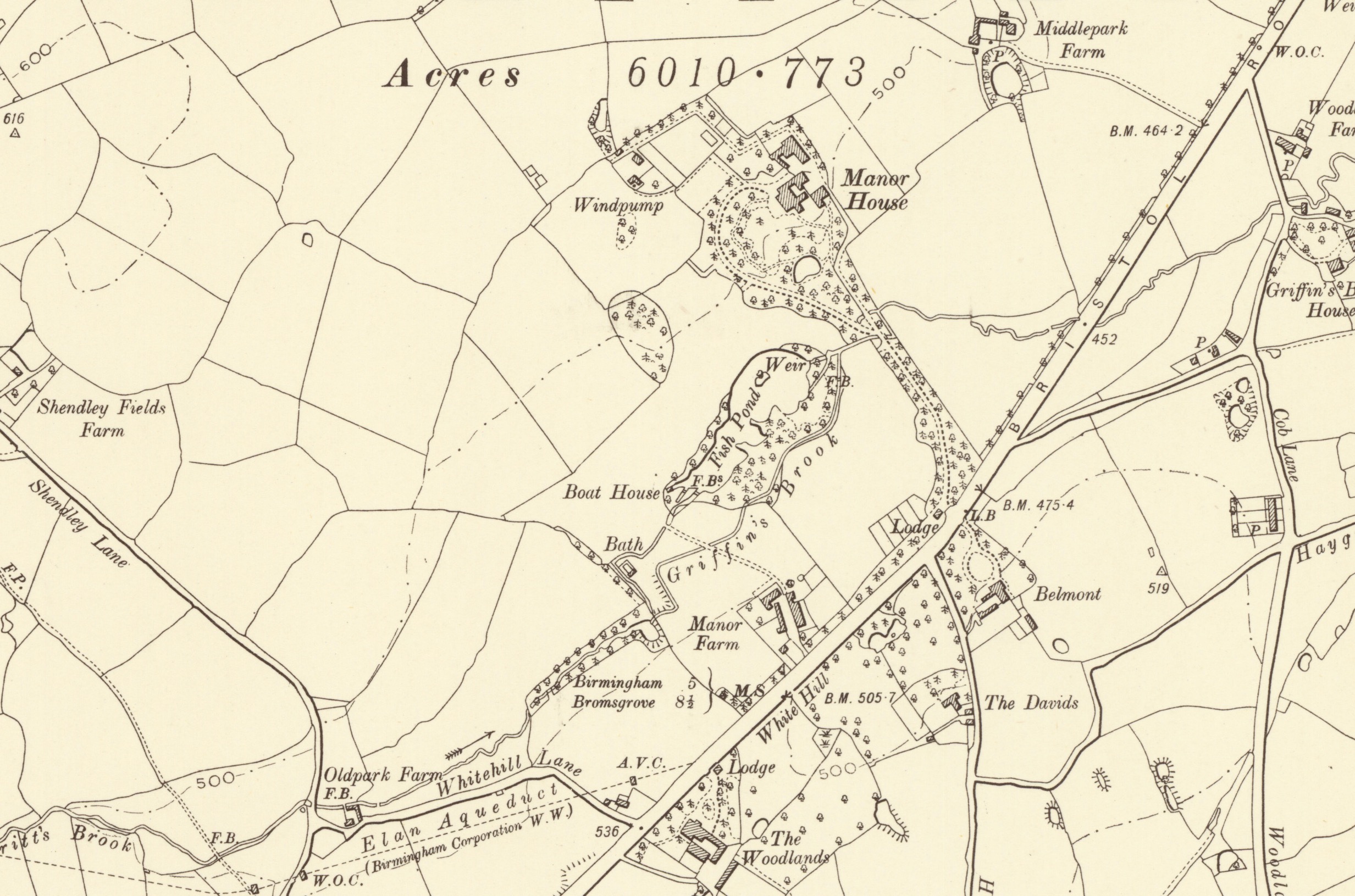
The main change within the park shown on the OS Map of 1905 (surveyed in 1902-03) is the layout of Manor Farm, comprising two opposing ranges of buildings separated by an accessway off Bristol Road South. The north-eastern range is composed of two detached elements, which are now the City’s Parks Depot. The opposite range is also L-shaped in plan. The south-eastern ends of both these ranges were sub-divided and were probably in use as stables or cowsheds. To the rear the L-shaped structure was the ‘Cadbury Barn’. There is also the Lodge with a garden adjoining modern Bristol Road South.
The large pond is now labelled ‘Fishpond’. To the south of the fishpond a new culverted course of the Griffin’s Brook has been cut to the southeast of the historic route. As mapped, it does not appear to have been joined to the historic course of the brook at its southern end. The L-shaped building (White Hill Farm) in the extreme south-eastern angle of the park continues to be mapped, together with Old Park Farm (along Whitehill Lane). Outside the park the ornamental gardens of the Manor House are mapped to the south of the house. The park surrounds continue to be rural in character into the 20th century, despite some development along the south-eastern frontage of modern Bristol Road South.