The Ordnance Survey (Fourth Edition) Map 1938
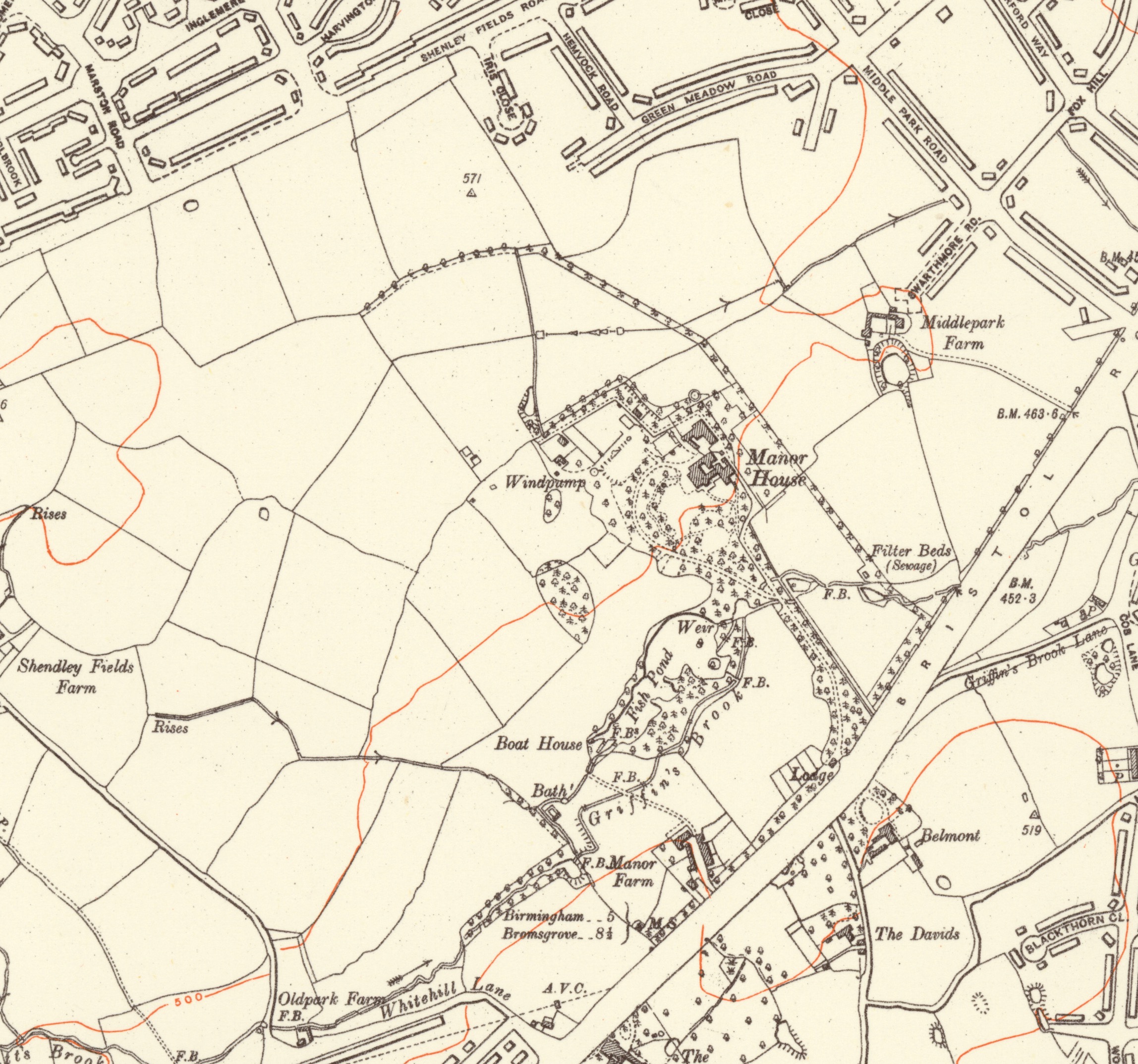
The park layout is mostly unchanged from 1916. The Bath first mapped in 1916 continues to be illustrated. An adjoining hydraulic ram is mapped for the first time. The Manor Farm outbuildings appear unchanged from 1916.
The freestanding structure at the north-western end of the south-eastern block has now been demolished, and the remainder of this block has been reduced in length. The right angled stable blocks facing the road belonging to both blocks have now been demolished. Wall scars are visible on the rear elevation of the southwestern block, to indicate the former position of demolished elements.
The detached house towards the road frontage still stands. Although the immediate environs of the park remain undeveloped, a number of residential streets have been laid out, including Middle Park Road and Shenley Fields Road to the north of the park. Despite this development, the Middle Park Farm compound survives. To the south of the park houses have been built along Whitehill Lane and the adjoining Nigel Avenue. Development has also taken place to the southeast of Bristol Road South.
Although the map was surveyed in 1937/38 its publication was delayed until 1945 so this shows area in its pre-war state and the aerial photo shows the area of the park in 1945. 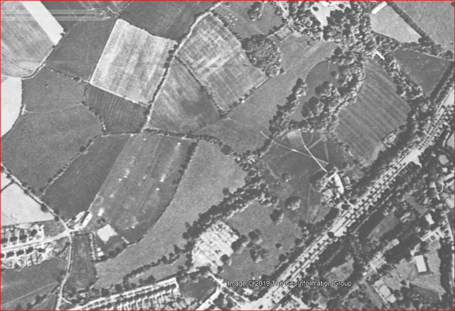
Return to Maps and Plans
'Reproduced with the permission of the National Library of Scotland'