Manor Farm Park “Features identified from Air Photograph”, by Tony Sames
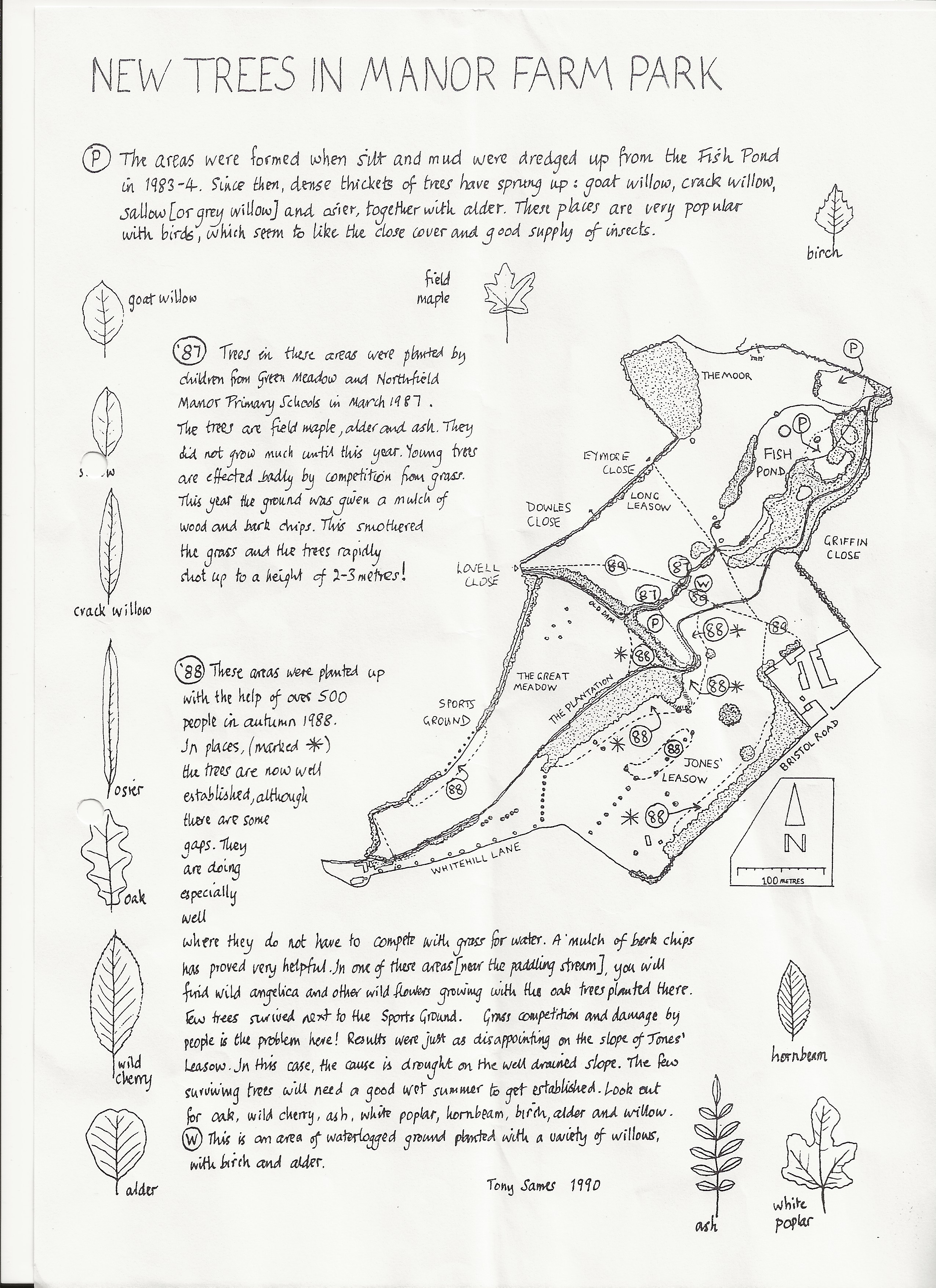
In Tony’s hand-drawn plan of the park, he combines his knowledge of its layout and features shown in an air photograph, taken some time between 1987 and 1989, to show areas of old ridge and furrow ploughing left from the time the park was farmland. The most visible remnants can be seen on Jones’ Leasow, which is south-east of the Plantation.
Click here for more information about the trees in Manor Farm Park.