Bernard Sleigh Map of Bournville 1923

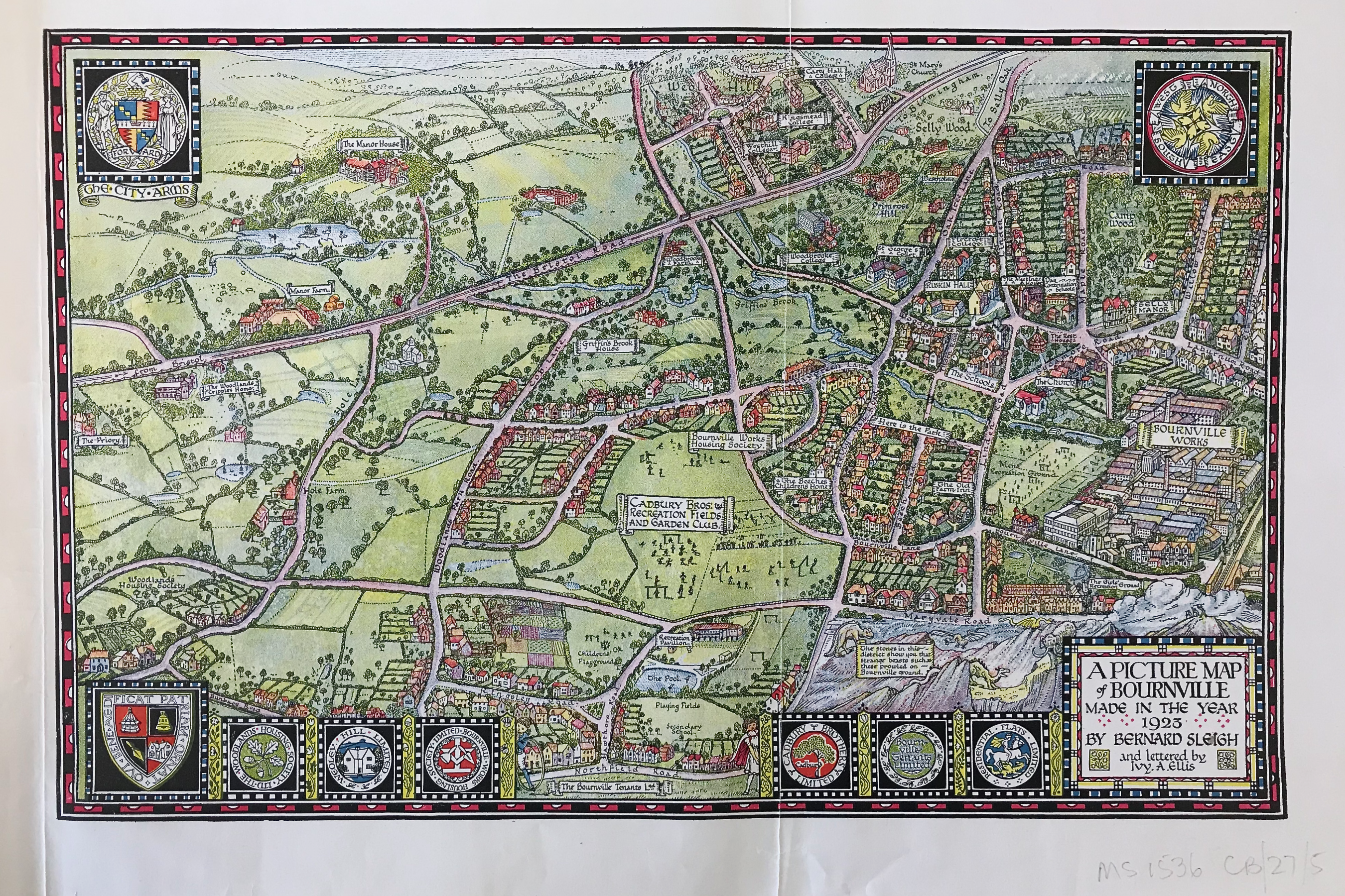
Bernard Sleigh map of Bournville 1923 1

Bernard Sleigh was born in Kings Norton in 1872, left school at 14 to work as a commercial wood engraver and studied at the Birmingham School of Art. Inspired by the Arts and Crafts movement, he produced murals, stained glass, illustrations and engravings. He was a fellow of the Royal Birmingham Society of Artists and in1923 produced a map of Bournville which shows the park and surrounding land. In 1925 he created a world map for Cadbury’s marketing campaign called “Story of Cadbury Chocolate and Bournville Cocoa”. He retired to Oxfordshire in 1937 and died in 1954. Click here for a larger copy of the map.


Return to Maps and Plans

Link to plan 

Back to top of page

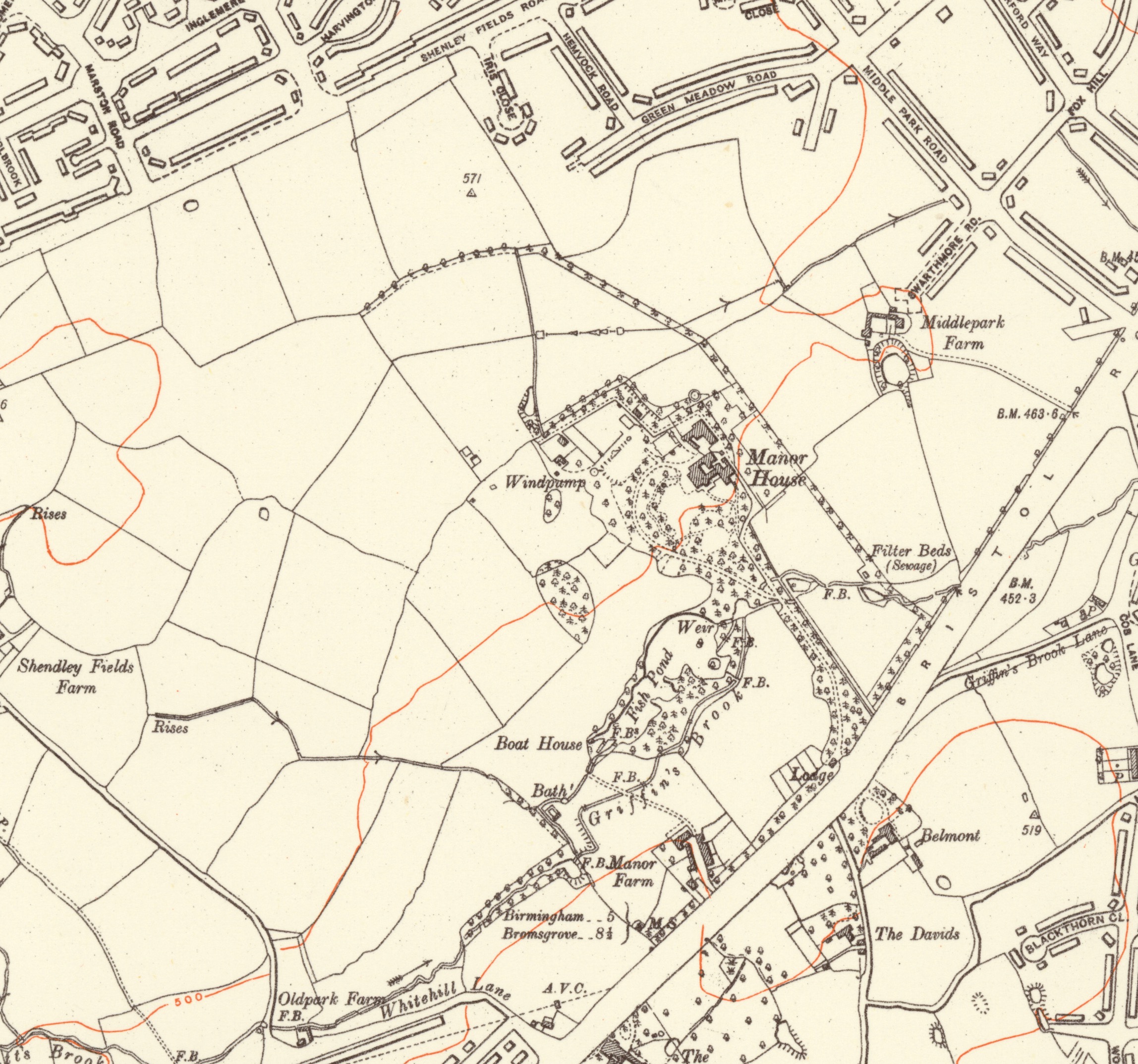
The Ordnance Survey (Fourth Edition) Map 1938 
OS 1938 reduced

The park layout is mostly unchanged from 1916. The Bath first mapped in 1916 continues to be illustrated. An adjoining hydraulic ram is mapped for the first time. The Manor Farm outbuildings appear unchanged from 1916. 

The freestanding structure at the north-western end of the south-eastern block has now been demolished, and the remainder of this block has been reduced in length. The right angled stable blocks facing the road belonging to both blocks have now been demolished. Wall scars are visible on the rear elevation of the southwestern block, to indicate the former position of demolished elements. 

The detached house towards the road frontage still stands. Although the immediate environs of the park remain undeveloped, a number of residential streets have been laid out, including Middle Park Road and Shenley Fields Road to the north of the park. Despite this development, the Middle Park Farm compound survives. To the south of the park houses have been built along Whitehill Lane and the adjoining Nigel Avenue. Development has also taken place to the southeast of Bristol Road South.

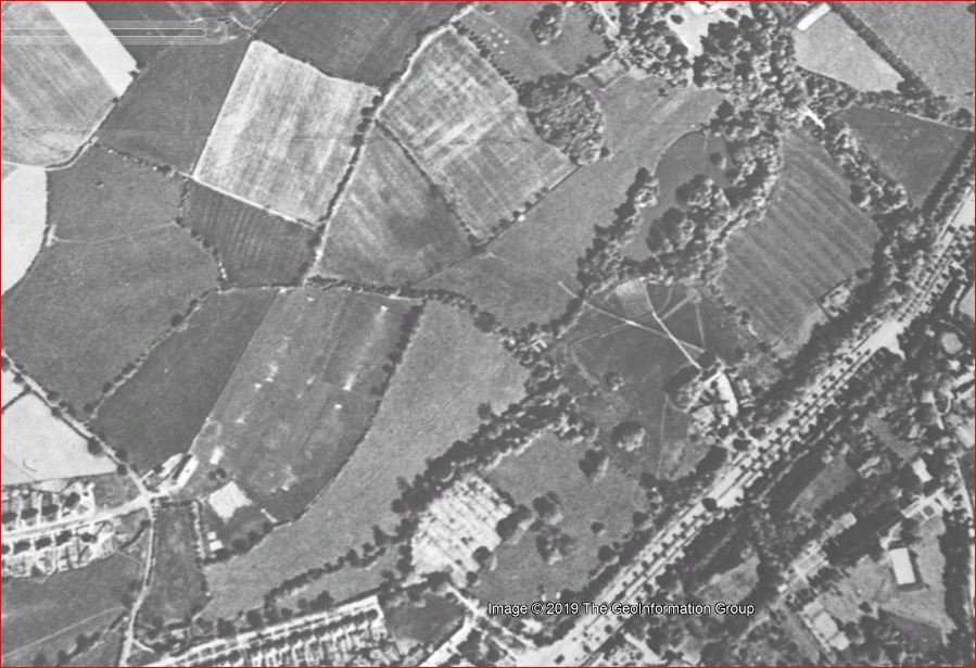
Although the map was surveyed in 1937/38 its publication was delayed until 1945 so this shows area in its pre-war state and the aerial photo shows the area of the park in 1945. MFP 1945
Return to Maps and Plans

'Reproduced with the permission of the National Library of Scotland'
The Ordnance Survey (Second Edition) Six Inch Map 1905

 1904 Reduced

'Reproduced with the permission of the National Library of Scotland'
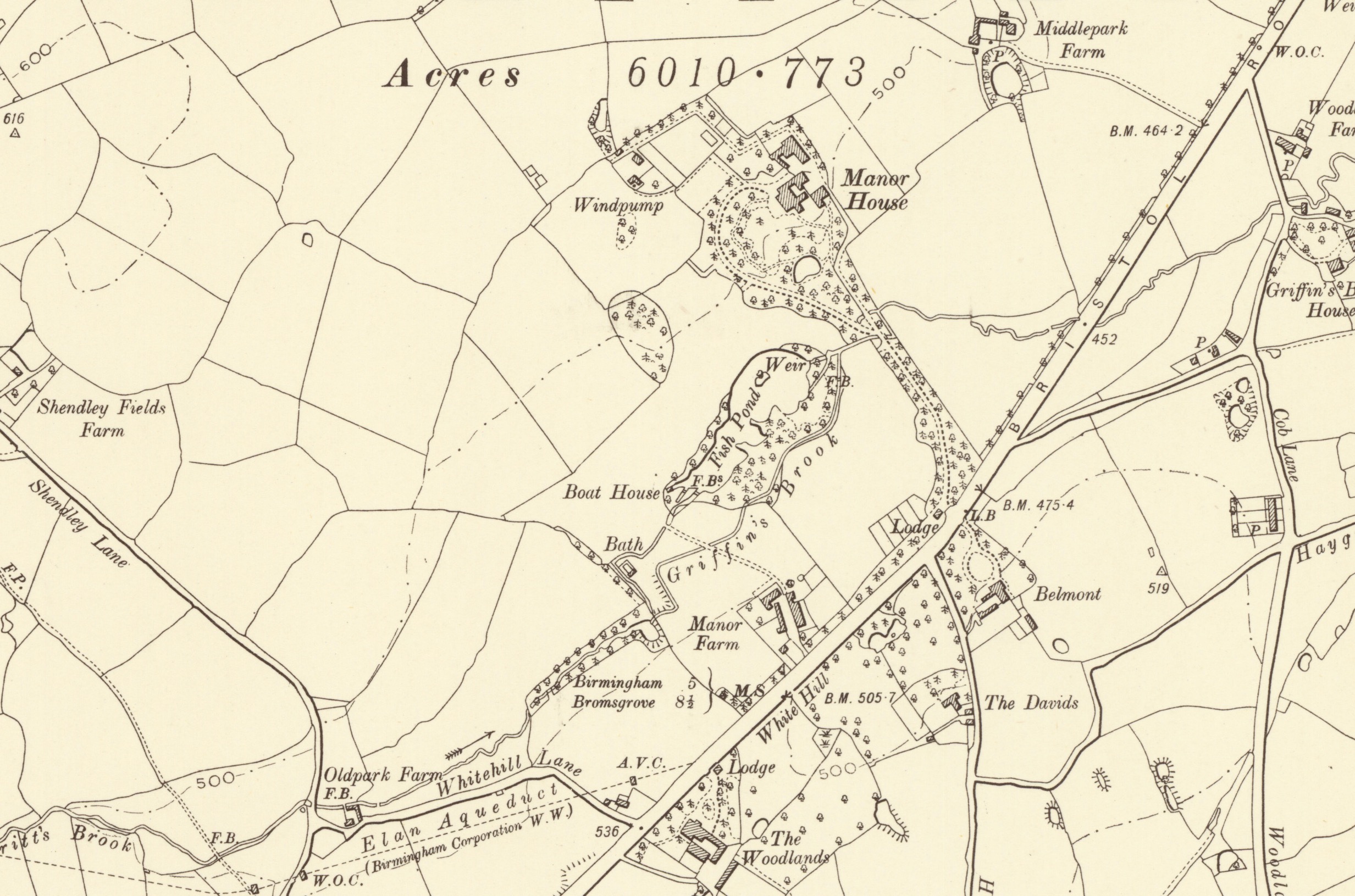
The main change within the park shown on the OS Map of 1905 (surveyed in 1902-03) is the layout of Manor Farm, comprising two opposing ranges of buildings separated by an accessway off Bristol Road South. The north-eastern range is composed of two detached elements, which are now the City’s Parks Depot. The opposite range is also L-shaped in plan. The south-eastern ends of both these ranges were sub-divided and were probably in use as stables or cowsheds. To the rear the L-shaped structure was the ‘Cadbury Barn’. There is also the Lodge with a garden adjoining modern Bristol Road South. 

The large pond is now labelled ‘Fishpond’. To the south of the fishpond a new culverted course of the Griffin’s Brook has been cut to the southeast of the historic route. As mapped, it does not appear to have been joined to the historic course of the brook at its southern end. The L-shaped building (White Hill Farm) in the extreme south-eastern angle of the park continues to be mapped, together with Old Park Farm (along Whitehill Lane). Outside the park the ornamental gardens of the Manor House are mapped to the south of the house. The park surrounds continue to be rural in character into the 20th century, despite some development along the south-eastern frontage of modern Bristol Road South.

Return to Maps and Plans

Link to larger version